Image Credit: Photos may include images from Wikimedia Commons, licensed under CC BY 2.0 , CC BY-SA 2.0, CC BY 3.0 OR CC BY_SA 4.0
"Everest Base Camp Trek"
12
Days
Trip Cost
Overview
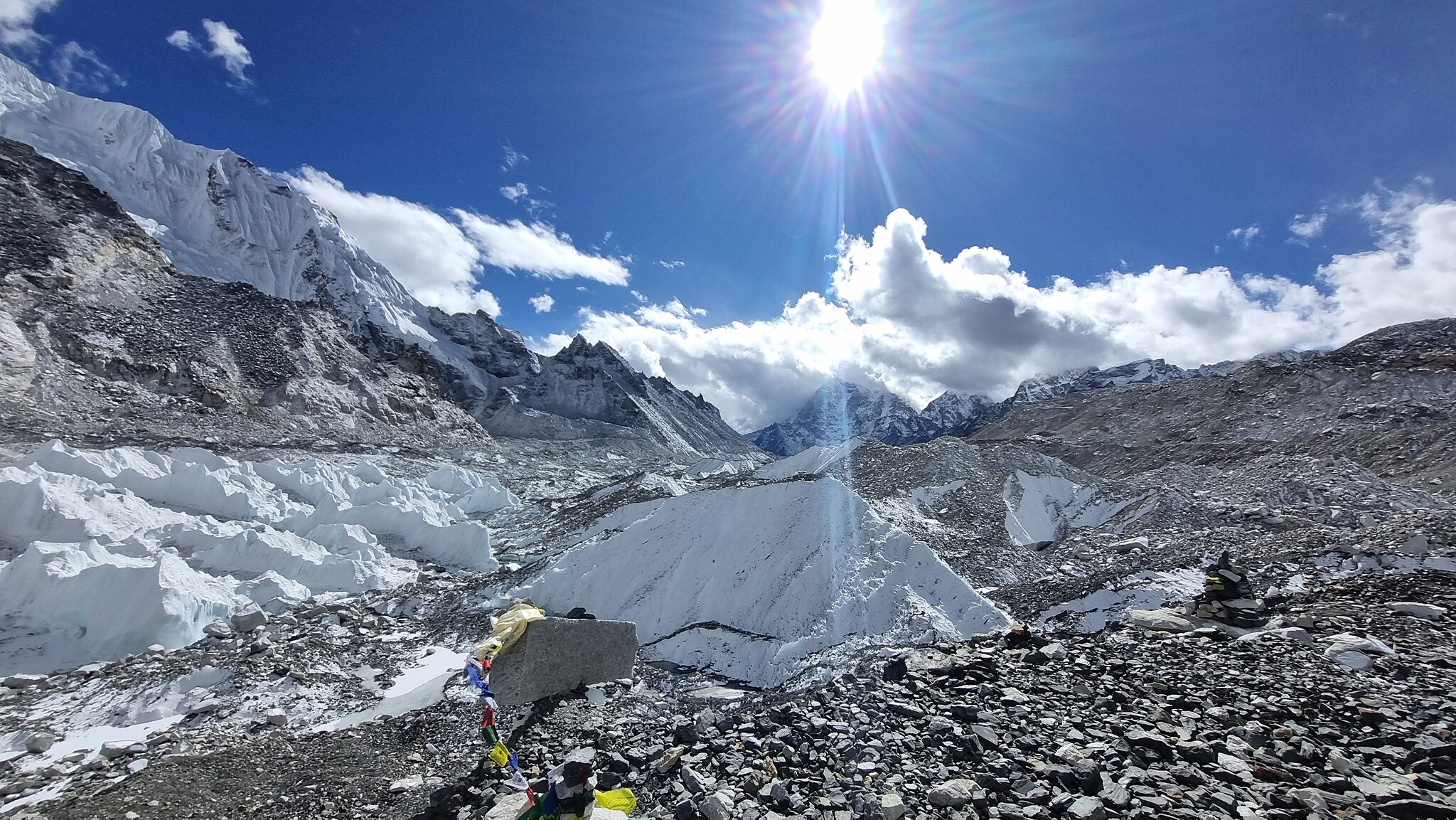
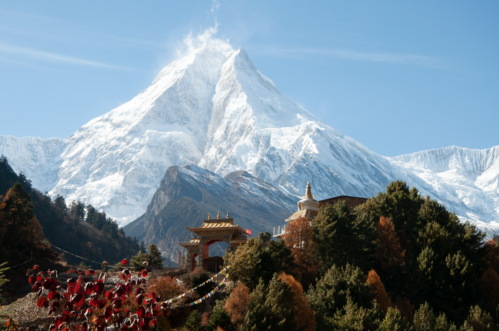
Classic trek to the base of the world’s highest mountain via Sherpa villages, monasteries, and Khumbu Glacier.
Highlights
Scenic Lukla flight
Sherpa culture in Namche Bazaar
Everest View Hotel hike
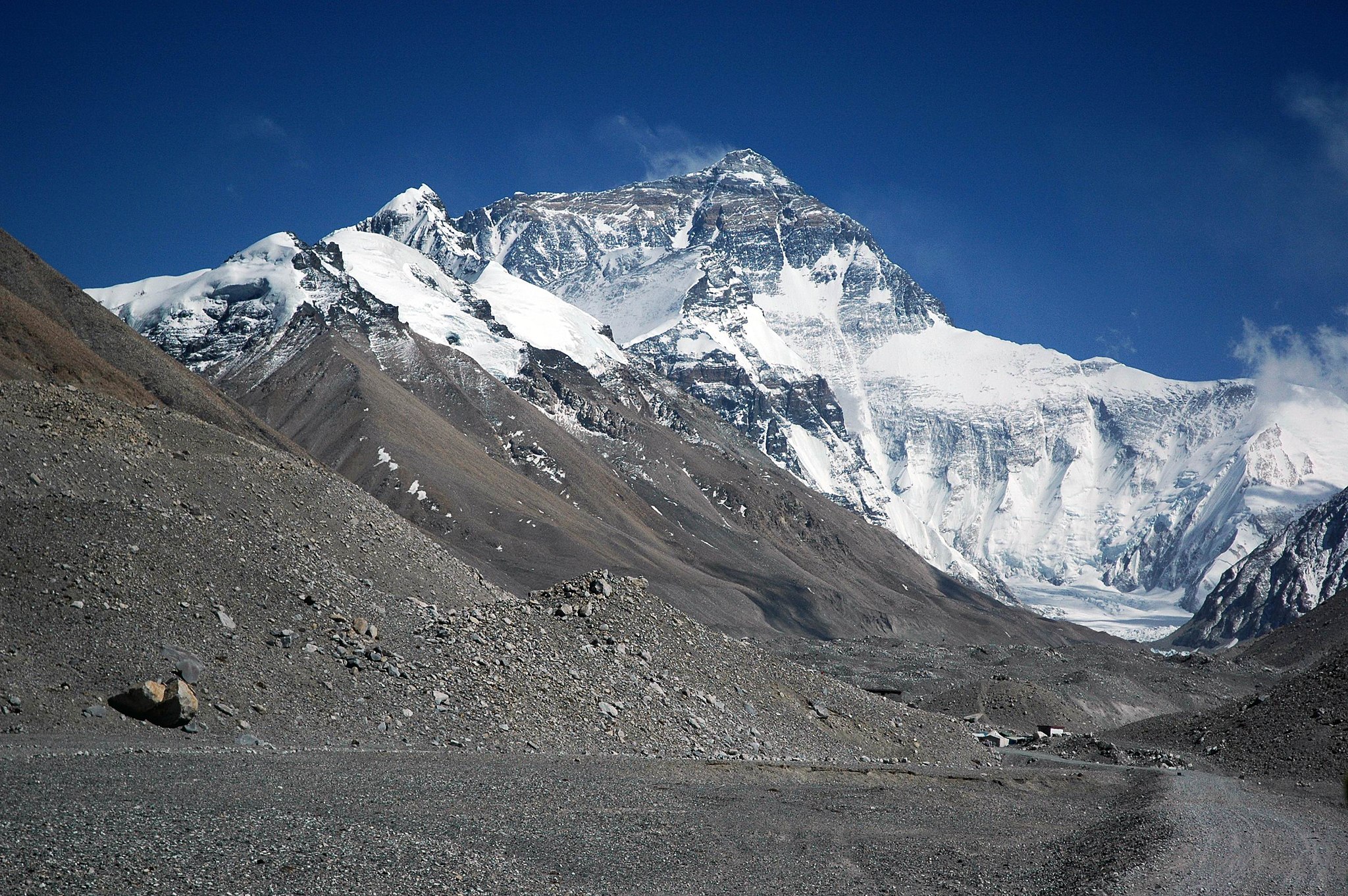
Kala Patthar sunrise (5,545m)
Kala Patthar sunrise (5,545m)
Itinerary
Day 1: Arrival in Kathmandu
⌄
Distance: —
Time: —
Start elevation: ~1,400 m (Kathmandu)
End elevation: ~1,400 m (Kathmandu)
Airport pickup and trek briefing.
Day 2: Fly to Lukla, Trek to Phakding
⌄
Distance: ~8 km
Time: 3–4 hours on foot
Start elevation: ~2,860 m (Lukla)
End elevation: ~2,610 m (Phakding)
Net change: ~250 m descent
Scenic mountain flight to Lukla followed by a short walk to Phakding.
Day 3: Phakding to Namche Bazaar
⌄
Distance: ~10–11 km
Time: 5–7 hours on foot
Start elevation: ~2,610 m (Phakding)
End elevation: ~3,440 m (Namche Bazaar)
Net gain: ~830 m
Cross suspension bridges and climb to the Sherpa capital, Namche Bazaar.
Day 4: Acclimatization Day in Namche Bazaar
⌄
Distance: ~4–6 km (acclimatization hike)
Time: 3–4 hours on foot
Start elevation: ~3,440 m (Namche Bazaar)
End elevation: ~3,880 m (Everest View Hotel area)
Return elevation: ~3,440 m
Explore Namche and hike to Everest View Hotel for Everest, Lhotse, and Ama Dablam views.
Day 5: Namche Bazaar to Tengboche
⌄
Distance: ~9–10 km
Time: 4–6 hours on foot
Start elevation: ~3,440 m (Namche Bazaar)
End elevation: ~3,860 m (Tengboche)
Net gain: ~420 m (with significant ups and downs)
Day 6: Tengboche to Dingboche
⌄
Distance: ~11–12 km
Time: 5–6 hours on foot
Start elevation: ~3,860 m (Tengboche)
End elevation: ~4,410 m (Dingboche)
Net gain: ~550 m
Gradual ascent along the Imja Valley with impressive Himalayan views.
Day 7: Dingboche to Lobuche
⌄
Distance: ~7–8 km
Time: 4–5 hours on foot
Start elevation: ~4,410 m (Dingboche)
End elevation: ~4,940 m (Lobuche)
Net gain: ~530 m
High-altitude trek past memorials honoring climbers.
Day 8: Lobuche to Gorakshep
⌄
Distance: ~4–5 km
Time: 2–3 hours on foot
Start elevation: ~4,940 m (Lobuche)
End elevation: ~5,164 m (Gorakshep)
Net gain: ~224 m
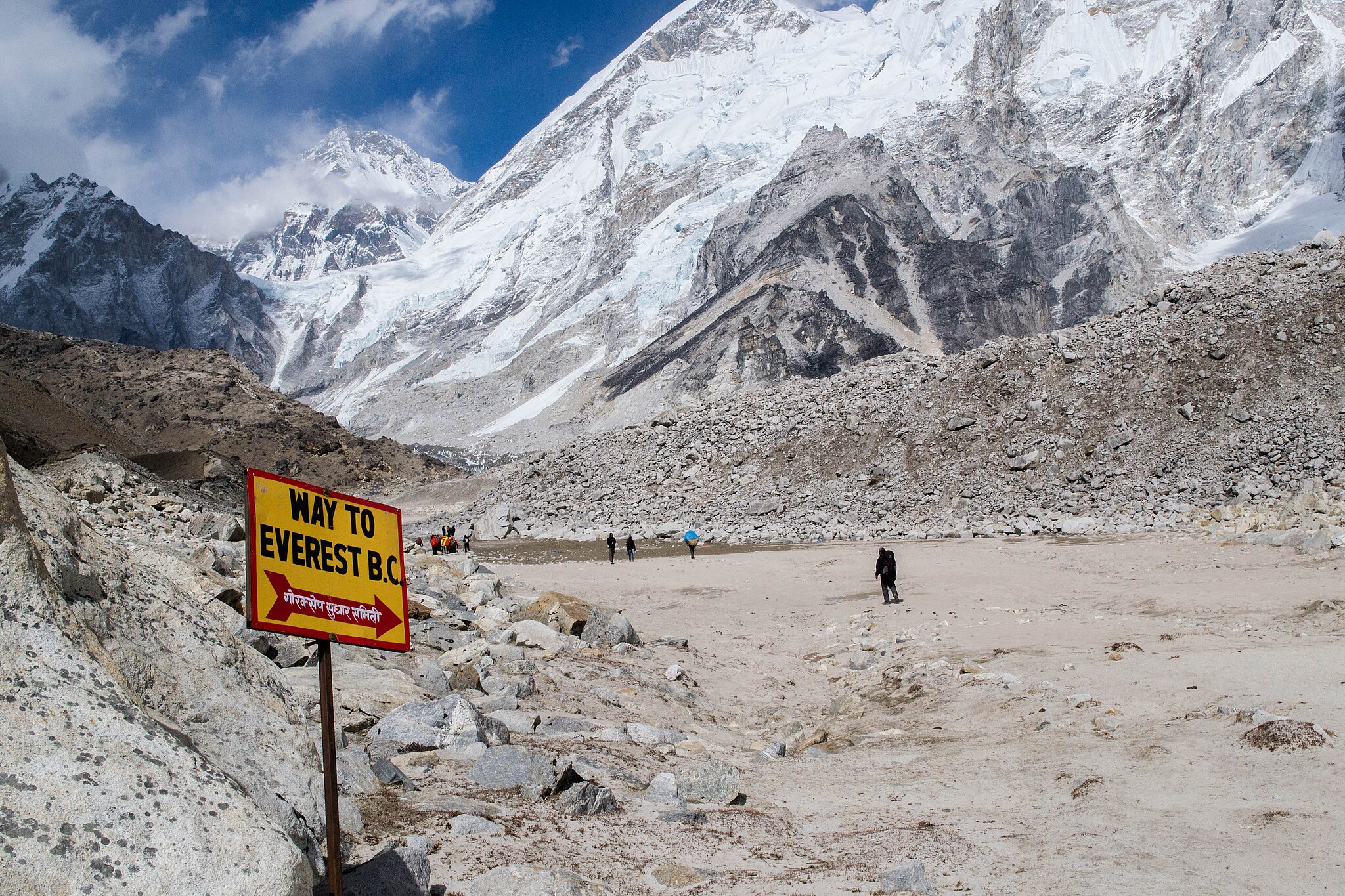
Reach Gorakshep, the last settlement before Everest Base Camp.
Day 9: Kala Patthar Sunrise, Trek to Pheriche
⌄
Distance: ~13–14 km
Time: 6–8 hours on foot
Start elevation: ~5,164 m (Gorakshep)
Highest point: ~5,545 m (Kala Patthar)
End elevation: ~4,371 m (Pheriche)
Net change: ~793 m descent after summit hike
Early hike to Kala Patthar for sunrise over Everest, then descend to Pheriche.
Day 10: Pheriche to Namche Bazaar
⌄
Distance: ~14–15 km
Time: 6–7 hours on foot
Start elevation: ~4,371 m (Pheriche)
End elevation: ~3,440 m (Namche Bazaar)
Net change: ~931 m descent
Comfortable descent with wide valley views.
Day 11: Namche Bazaar to Lukla
⌄
Distance: ~18–19 km
Time: 6–8 hours on foot
Start elevation: ~3,440 m (Namche Bazaar)
End elevation: ~2,860 m (Lukla)
Net change: ~580 m descent
Return through Namche and follow the Dudh Koshi River.
Day 12: Lukla to Kathmandu
⌄
Distance: —
Time: ~30–35 minute flight
Start elevation: ~2,860 m (Lukla)
End elevation: ~1,400 m (Kathmandu)
Return flight to Kathmandu.
Costs
EBC
The Cost Includes
Domestic flights (Kathmandu–Lukla–Kathmandu)
Hotel Accommodation for 2 Nights
Accommodation and full-board meals during trek
Licensed trekking guide and porter
Trek permits and TIMS
Airport transfers
The Cost Excludes
International airfare to/from Kathmandu
Nepal visa fees
Travel and rescue insurance
Personal expenses (hot shower, Wi‑Fi, charging, drinks)
Tips for guide and porter
Extra accommodation/meals due to flight delays
Any services not menti
FAQ's
What is the maximum altitude? Is this trek suitable for beginners?
⌄
5,545 meters at Kala Patthar.
Yes, with good fitness and proper acclimatization.
Map
Enquiry Form
You can send your enquiry via the form below.
Price
From
$1550/Person
Next Departure:
- Jan 2025
- Feb 2025
- March 2025
- April 2025
Need help in booking ? Enquiry Now
Transportation
Bus
Accomodation
3 full
Maximum
Altitude
5364
Departure
from
Kathmandu
Best
season
Winter
Tour
type
Nature Friendly
Meals
full course
Language
Nepali, English, Hindi
Fitness
level
High
Group
Size
6-14
Minimum
Age
12
Maximum
Age
70
Explore Related Trips
© Copyright 2025 Thankyounepaltrip.com | Travel your dream Destinations in Nepal.
Secured Payment: